Difference between revisions of "ICT student textbook/Data can tell stories"
Jump to navigation
Jump to search
| Line 39: | Line 39: | ||
# Folders with different data sets will be shared on each computer | # Folders with different data sets will be shared on each computer | ||
# Each group of students will get one data set to work with - this will comprise maps, satellite images, pictographs and bar graphs. Your teacher will also give you a set of questions for each data set. | # Each group of students will get one data set to work with - this will comprise maps, satellite images, pictographs and bar graphs. Your teacher will also give you a set of questions for each data set. | ||
| − | # Data sets are given below: | + | # # Summarize your findings in a text document. Data sets are given below: |
'''Rainfall''' | '''Rainfall''' | ||
{| class="wikitable" | {| class="wikitable" | ||
| Line 61: | Line 61: | ||
|style="width: 25%;"|[[File:Andhra_Pradesh_and_Telangana_Physical.jpeg|200px|Topography Telangana and AP]] | |style="width: 25%;"|[[File:Andhra_Pradesh_and_Telangana_Physical.jpeg|200px|Topography Telangana and AP]] | ||
|style="width: 25%;"|[[File:Indian_Forest_Cover.png|200px|Indian Forest Cover]] | |style="width: 25%;"|[[File:Indian_Forest_Cover.png|200px|Indian Forest Cover]] | ||
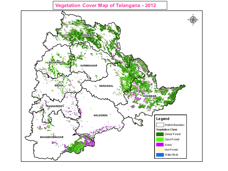
| − | |style="width: 25%;"| | + | |style="width: 25%;"|{{ext-img|200px|https://upload.wikimedia.org/wikipedia/en/b/bb/TSforestcover.png}} |
|style="width: 25%;"|[[File:AreaUnderWildlifeSanctuariesIndia2006.png|200px|Data on sanctuaries]] | |style="width: 25%;"|[[File:AreaUnderWildlifeSanctuariesIndia2006.png|200px|Data on sanctuaries]] | ||
|} | |} | ||
| − | |||
| − | |||
| − | |||
=Portfolio= | =Portfolio= | ||
#Text document with analysis of data | #Text document with analysis of data | ||
Revision as of 15:01, 15 October 2016
Data can tell stories

Objectives
- Understand that data can be in different formats
- Reading different kinds of data to make meaning
- Analyzing and expressing
What prior skills are assumed
- Creating folders and saving files
- Opening a given file with the correct application
- Familiarity with using a key board
Resources needed
Hardware, software, Files
- Data in the form of bar graphs, pictographs, maps (images)
- Computer lab with projection
- Access to internet
- Handout - Learn Ubuntu
- Handout - Learn LibreOffice Writer
Description of activity with detailed steps
Teacher led activity

|
|
Student activities
- Folders with different data sets will be shared on each computer
- Each group of students will get one data set to work with - this will comprise maps, satellite images, pictographs and bar graphs. Your teacher will also give you a set of questions for each data set.
- # Summarize your findings in a text document. Data sets are given below:
Rainfall

|

|

|

|
Pictographs-one per group

|

|

|

|
India's forests

|

|
|

|
Portfolio
- Text document with analysis of data