File:COL - Concept Map of DST.png
From Open Educational Resources
Size of this preview: 800 × 450 pixels. Other resolutions: 320 × 180 pixels | 1,366 × 768 pixels.
Original file (1,366 × 768 pixels, file size: 138 KB, MIME type: image/png)
Summary
| Description |
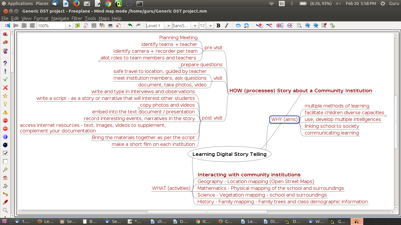
COL - Concept Map of DST |
| Date | 23-02-2017 |
| Source | Screenshot of application captured by IT for Change |
| Author | IT for Change /Freeplane Developers |
| Permission |
GPL |
Licensing

|
Permission is granted to copy, distribute and/or modify this document according to the terms in Creative Commons License, Attribution 4.0. The full text of this license may be found here: CC by 4.0 |
File history
Click on a date/time to view the file as it appeared at that time.
| Date/Time | Thumbnail | Dimensions | User | Comment | |
|---|---|---|---|---|---|
| current | 13:37, 23 February 2017 | | 1,366 × 768 (138 KB) | Venkatesh (talk | contribs) | {{Information |Description=COL - Concept Map of DST |Date=23-02-2017 |Source=Screenshot of application captured by IT for Change |Author=IT for Change /GIMP Developers |Permission=GPL }} [[Category:Graphics of "Teachers' toolkit for creating and re-pur... |
You cannot overwrite this file.
File usage
There are no pages that use this file.